Log in
All resources
Create a design
324 Free Artworks of 17th Century Maps Of France
bibliothèque nationale de france
maps by willem and johannes blaeu
baroque
maps by matthäus merian
matthäus merian
maps by pieter van der keere
tresor des cartes geographiques (1659)
17th-century maps of xaintonge
maps by jodocus hondius
maps from gallica
maps by willem and johannes blaeu
1640 maps of africa
bibliothèque municipale de reims, rès. g 153
baroque
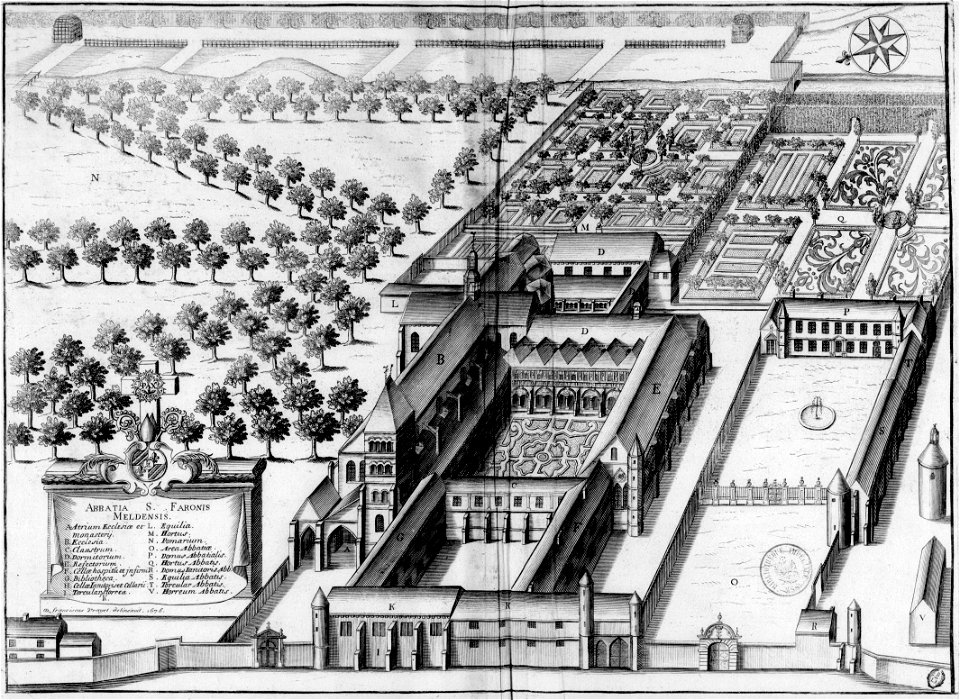
monasticon gallicanum (abbaye en île-de-france)
maps of meaux
17th-century maps of xaintonge
maps by jodocus hondius
atlas minor gerardi mercatoris (1621, maps)
17th-century maps of siberia
17th-century maps of france
old maps of loiret
theatre geographique du royaume de france (1632)
maps of perigord
italia - di matteo greuter... - btv1b525056959
17th-century maps of istria
17th-century maps of venice
baroque
maps by hendrik hondius the younger
17th-century maps of south america
bibliothèque nationale de france
maps of goa by linschoten
map of paris by claes jansz. visscher - derivate files
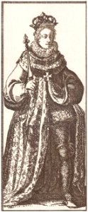
17th-century people of paris
map of paris by claes jansz. visscher - derivate files
17th-century people of paris
17th-century maps of france
maps of touraine
old maps of nassau
salomon rogiers
maps by hendrik hondius the younger
old maps of overijssel
17th-century maps of tartary
17th-century maps of siberia
17th-century maps of africa
maps from gallica
maps of barcelona by braun & hogenberg
1645 in andalusia
françois de la pointe
1620s maps of france
maps by pieter van der keere
maps by abraham ortelius
maps by jodocus hondius ii
17th-century maps of asia
17th-century maps of moscow
baroque
atlas maior, vol 7 (france i) - joan blaeu, 1667 - bl 114.h(star).7
1667 maps
tresor des cartes geographiques (1659)
17th-century celestial maps
tresor des cartes geographiques (1659)
17th-century maps of morocco
tresor des cartes geographiques (1659)
17th-century maps of scandinavia
tresor des cartes geographiques (1659)
17th-century maps of the arctic
17th-century maps of the malay archipelago
tresor des cartes geographiques (1659)
tresor des cartes geographiques (1659)
17th-century maps of morocco
tresor des cartes geographiques (1659)
17th-century maps of the british isles
17th-century maps of france
loudun (territorio)
atlas minor gerardi mercatoris (1614, maps)
17th-century double hemisphere world maps
maps by willem and johannes blaeu
1640s maps
17th-century maps of maastricht
baroque
17th-century maps of the strait of magellan
maps by jodocus hondius
maps of rotterdam by braun & hogenberg
maps of delft by braun & hogenberg
1610s maps of the holy roman empire
jacques surhon
maps of france by hendrik hondius
17th-century maps of xaintonge
17th-century maps of the mediterranean sea
1610 maps of europe
venezuela cum parte australi novae andalusiae - btv1b8596473x
maps by hendrik hondius the younger
old maps of westphalia
johannes gigas
17th-century maps of savoie
old maps of savoie
maps by willem and johannes blaeu
17th-century maps of xaintonge
old maps of leiden
baroque
17th-century maps of switzerland
maps by pieter van der keere
17th-century maps of france
history of perche
maps by pieter mortier
maps from gallica
bourbonnais in the 17th century
pierre mariette i
17th-century maps of carmarthenshire
17th-century maps of pembrokeshire
17th-century maps of poitou
1660s maps of france
1669 maps of south america
guillaume sanson
maps by hendrik hondius the younger
1630s maps of the world
maps by willem and johannes blaeu
17th-century maps of xaintonge
17th-century maps of luxembourg
maps by pieter van der keere
collections of the blanton museum of art
maps by alexis-hubert jaillot
17th-century maps of the indian ocean
maps by willem and johannes blaeu
maps by matthäus merian
baroque
maps of blois by braun & hogenberg
urbanisation in loir-et-cher
17th-century maps of crete
old maps of candia
17th-century maps of xaintonge
maps by jodocus hondius ii
buda in the 17th century
baroque
17th-century maps of nord (department)
maps of artois
maps of the course of the rhine by guillaume sanson
bibliothèque nationale de france
17th-century maps of the indian ocean
maps by willem and johannes blaeu
17th-century maps of france
description de l'universe
17th-century maps of france
description de l'universe
maps of île-de-france by françois de la guillotière
bibliothèque nationale de france
maps by pieter van der keere
maps by abraham ortelius
atlas van der hagen (volume 3)
atlas van der hagen
italia - di matteo greuter... - btv1b525056959
17th-century maps of corsica
maps by willem and johannes blaeu
17th-century maps of dombes
landkreis eichsfeld in the 17th century
maps from gallica
maps of île-de-france by françois de la guillotière
bibliothèque nationale de france
maps by willem and johannes blaeu
17th-century maps of lorraine
maps by willem and johannes blaeu
17th-century maps of bourgogne
maps by willem and johannes blaeu
17th-century maps of dombes
17th-century maps of england and wales
maps by jodocus hondius
17th-century maps of southern africa
maps by willem and johannes blaeu
atlas maior, vol 7 (france i) - joan blaeu, 1667 - bl 114.h(star).7
1667 maps
château de cheverny
étienne martellange
17th-century maps of vienna
dancker danckerts
old maps of the republic of genoa
maps by willem and johannes blaeu
17th-century maps of crete
old maps of candia
maps by pieter van der keere
17th-century maps of silesia
maps of ports and fortresses of the mediterranean by marco boschini (1651)
old maps of souda (crete)
map of europe by nicolas and guillaume sanson (1669)
bibliothèque nationale de france
17th-century maps of france
description de l'universe
maps by willem and johannes blaeu
17th-century maps of lorraine
old maps of riga
baroque
old maps of enkhuizen
baroque
17th-century maps of the netherlands
maps by pieter van der keere
maps by willem and johannes blaeu
17th-century maps of bermuda
pieter verbiest (ii)
maps from gallica
17th-century maps of dorset
maps by john speed
17th-century maps of scotland
maps of islay
map of the circle of lower saxony by sanson
bibliothèque nationale de france
maps of ancient italy by philipp clüver
old maps of the alps
maps by willem and johannes blaeu
17th-century maps of xaintonge
17th-century maps of london
baroque
101 - 200 of 324
Next page
/ 4


![Treasure of geographical maps of the main states of the universe [...], 1659](https://cdn.creazilla.com/illustrations/10000284064/treasure-of-geographical-maps-of-the-main-states-of-the-universe-1659-md.jpg)
![Treasure of geographical maps of the main states of the universe [...], 1659](https://cdn.creazilla.com/illustrations/10000171002/treasure-of-geographical-maps-of-the-main-states-of-the-universe-1659-md.jpg)
![Treasure of geographical maps of the main states of the universe [...], 1659](https://cdn.creazilla.com/illustrations/10001044907/treasure-of-geographical-maps-of-the-main-states-of-the-universe-1659-md.jpg)
![Treasure of geographical maps of the main states of the universe [...], 1659](https://cdn.creazilla.com/illustrations/10000859165/treasure-of-geographical-maps-of-the-main-states-of-the-universe-1659-md.jpg)
![Treasure of geographical maps of the main states of the universe [...], 1659](https://cdn.creazilla.com/illustrations/10001373480/treasure-of-geographical-maps-of-the-main-states-of-the-universe-1659-md.jpg)


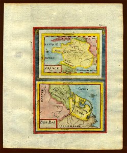
![Xaintonge and Angoumois / [Blaeu], 1635](https://cdn.creazilla.com/illustrations/10000256086/xaintonge-and-angoumois-blaeu-1635-sm.webp)


![Duchy of Bourbonnois / [Pierre Mariette], Pierre Mariette I, 1668](https://cdn.creazilla.com/illustrations/10000233377/duchy-of-bourbonnois-pierre-mariette-pierre-mariette-i-1668-md.jpg)


![Xaintonge with the country of Aulnis, Brovageais, land of Arvert etc. / [Blaeu], 1662](https://cdn.creazilla.com/illustrations/10001453725/xaintonge-with-the-country-of-aulnis-brovageais-land-of-arvert-etc-blaeu-1662-sm.jpg)


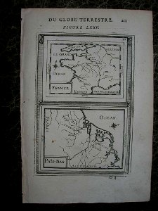

![The sovereignty of Dombes / [Blaeu], 1635](https://cdn.creazilla.com/illustrations/10000648992/the-sovereignty-of-dombes-blaeu-1635-md.jpg)


![Lotharingia ducatus, vulgo Lorraine / [Blaeu], 1631](https://cdn.creazilla.com/illustrations/10000348612/lotharingia-ducatus-vulgo-lorraine-blaeu-1631-sm.webp)


